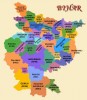

- Araria
- Arwal
- Aurangabad
- Banka
- Begusarai
- Bhabhua
- Bhagalpur
- Bhojpur
- Buxar
- Darbhanga
- East Champaran
- Gaya
- Gopalganj
- Jamui
- Jehanabad
- Katihar
- Khagaria
- Kishanganj
- Lakhisarai
- Madhepur
- Madhubani
- Munger
- Muzaffarpur
- Nalanda
- Nawada
- Patna
- Purnia
- Rohtas
- Saharsa
- Samastipur
- Saran
- Sheohar
- Shiekhpura
- Sitamarhi
- Siwan
- Supaul
-
Araria : Introduction
The Araria District came into existence in 1990 on the auspicious day of Makar-Sankranti, at the time when the Purnea district was divided into three parts, Purnea, Araria and Kishanganj.
Araria is situated in the southern part of Purnia and Medhepura in Bihar. The district Araria is surrounded by Nepal in northern side, Kishanganj in western side and Supaul at south-eastern side.
Jogbani is the last point of Araria district and after that Virat Nagar district from where the borders of Nepal start. So this district is also important in the terms of border security.
The rivers Kosi, Suwara, Kali and Koli flow through the district.
Facts & FiguresYear of formation1990Area2,830 Sq. kmLatitude26.09 NLongitude87.33 EAltitude47 MeterPopulation (2001)2125000Males1109000Females1016000Population density751 Per Sq. kmSex Ratio916No. of Sub-Division02No. of Tehsil09No. of Blocks09STD Code06453
How to reach
One can reach Araria by both roadways and railways as the district is well connected by both the mediums.
By Road
The district Araria has two bus terminals, one at the ‘0’ mile i.e. at the starting of the district border and the other one is inside the city. Buses for most of the districts and internal blocks are available from the bus terminal.
By rail
Train facility is available in the form of meter gauge track. The track on one side ends at Katihar which is a big and important junction. Other track end is at Jogbani which is also the last destination of the Indian Railways.
Connectivity
Nearest Railway Station: Araria court & Araria(R S)
Distance from Purnea: 42 Km.
Nearest Airport: Bagdogara
Distance from Nepal: 42 Km.
Arwal : Introduction
Arwal district was earlier a part of the Jehanabad district and it came into existence in September 2001.
The river Sone flows nearby the district.
Facts & FiguresYear of formation2001Total population587,229STD code06337
Connectivity
Arwal is situated 60 km south of Patna. The nearest airport is at Patna from where regular flights are available to all important towns and cities across the country. The nearest railway station is located at Jehanabad. By road, Arwal is efficiently linked with Jehanabad, Patna and Bhojpur.
Aurangabad : Introduction
Aurangabad district is the part of Magadh division. The nearest rivers flowing are Sone, Punpun, Auranga, Bataane, Morhar, Aadi.
Facts & FiguresLatitude24.45NLongitude84.18EPopulation (2001)2005000Males1036000Females969000Population density607 Per Sq. kmSex Ratio935Literacy Rate57.50%STD Code06186
Banka : Introduction
Banka district is a part of Bhagalpur Division.
Facts & FiguresArea3018 Sq. kmLatitude240 53NLongitude850 10EPopulation (2001)16,08,778 personsMales8,43,061Females7,65,717Population density533 Per Sq. kmSex Ratio908Literacy Rate43.40%No. of Sub-Division01No. of Blocks11STD Code06424
Begusarai : Introduction
Begusarai emerged as a separate district in 1972 when it was separated from the Munger district. Begusarai is located in the central part of North Bihar.
Begusarai extends perpendicularly from east to west which used to be a main link road. The district is bounded by Samastipur on the north, on the south by the Ganga and the Lakhisarai district, on the east by Khagaria and Munger and on the west by the Samastipur and Patna districts. Begusarai district is a part of Darbhanga division.
Begusarai district is located in the middle Ganga plain. Some of the main rivers following through the district are Burhi Gandak, Balan, Bainty, Baya and Chandrabhaga.
Facts & FiguresYear of formation2nd October 1972Area1879.675 Sq. kmLatitude25°15' and 25° 45' NLongitude85°45' and 86°36" EPopulation (2001)23,42,989Males12,26,057Females11,16,932Population density1222 Per Sq. kmSex Ratio911Literacy Rate48.55%No. of Sub-Division05No. of Blocks18No. of Villages1229Average rainfall1384 mmSTD Code06243
How to Reach
Begusarai is well connected to other parts of Bihar and India through railways and roadways.
Railways
The New Delhi- Guwahati railway line passes through Begusarai. Barauni Railway Junction holds an important place in the railway division map of Begusarai. Important trains that originate from this station to various parts in India connect Delhi, Guwahati, Amritsar, Varanasi, Lucknow, Mumbai, Chennai etc. Rajendra Setu on the Ganga is connected to Mokama and Howrah. The district has a total of 18 railway stations.
Roadways
The interiors parts of the district are well connected by the main roads. The National Highways 28 and 31 link this district to the other parts of the country.Bhabhua : Introduction
Kaimur was carved out from the Shahabad district. The district is bounded on the north by Buxar district and Ghazipur of UP, on the south by Garhwa district of Jharkhand. On the east it is bounded by Rohtas district and on the west by Chandauli and Mirjapur district of UP.
Rivers
Important rivers flowing through the district are Karmanasha, Dhoba, Durgawati.
Attractions
Important places to visit are Adhaura, Baidyanath, Bhabua, Bhagwanpur, Chainpur, Chorghatia, Durauli, Ramgarh
Facts & FiguresArea340441 Hec.Population (2001)12,84,575Males6,73,556Females6,11,019Population density382 Per Sq. K.M.Sex Ratio907Literacy Rate55.57%No. of Sub-Division02No. of Blocks11No. of Towns01No. of Villages1699STD Code06189
How to Reach
Roadways
NH 2 (G.T. Road) crosses through the center of the district from Karmanasha to Kudra for about 50 km. NH 30 originates from it near Mohania and connects this district with the capital Patna via Arah. Apart from these, there are also a few State Highways in the district.
Railways
Mohania Block is situated on Gaya-Mughalsarai Section of Grand Chord Railway line; the railway station is called Bhabua Road. The district headquarter is located at a distance of 14 Kms southward from the railway station or the G.T. Road.Bhagalpur : Introduction
Bhagalpur is one of the oldest districts of Bihar located in the Southern region. It is situated in the plains of Ganga basin at height of 141 feet above sea level.
It covers an area of 2569.50 sq. km. It Lies between 25°07 - 25°30'N Latitude and between 86°37 ' - 87°30 'E longitude.
The district is surrounded by Munger, Khagaria, Madhepura, Purnea, Kathiar & Banka districts of Bihar and Godda & Sahebganj districts of Jharkhand.
The important places to see are high tower at Bhagalpur town, temple of Dudheswara Mahadeva, the University & Jain temple at Nathanagar, Sultanganj, the royal university of Vikramsila, Mandar hills and Sahjangi
Facts & FiguresArea2569 Sq. kmLatitude250 07 - 250 30' NLongitude860 37 ' - 870 30 'EAltitude43 MetersPopulation (2001)24,30,331Males12,94,192Females11,36,139Population density946 Per Sq. kmSex Ratio878Literacy Rate50.28%No. of Sub-Division03No. of Blocks16No. of Villages1536Average rainfall1166.2 mm.TemperatureMax.: 44.5 0C ; Min.: 8 0CSTD Code0641
How to Reach
Roadways
National Highway 31 runs through the entire Naugachia Police District and subdivision. This highway connects the subdivisions directly to Patna via Begusarai and Khagaria and runs up to Guwahati via Purnea-Kishanganj. In addition, Mokama Farakka road has also been declared as National Highway No. 81. It passes through Bhagalpur town and Kahalgoan.
Railways
Bhagalpur lies on the broad gauge Loop line of the Eastern railway running from Kiul to Burdwan. Important stations in this District include Sultanganj, Bhagalpur, Sabour, Kahalgaon.
A branch line runs from Bhagalpur to Mandar Hill (21 Kms.). North Bhagalpur is served by the Barauni-Katihar section of the North Eastern Frontier Railway. Narainpur, Bihpur, Naugauchia and Katihar Railway Stations lie on this line.Bhojpur : Introduction
The Bhojpur district came into existence in 1992 before which it was a part of Sahabad district. The district has three sub divisions viz Ara Sadar, Jagdishpur and Piro. Ara town is the most important town of the district and is also the headquarters of the district.
The rivers Ganges and Sone flow through the district.
The important places to visit are Veer Kunwar Singh Kila at Jagdishpur, Maharaja College at Ara, Jain Mandir at Mahadeva, and Aranya Devi Temple.
Facts & FiguresYear of formation1992Area2474 sq. kms.Latitude25º 10' to 25º 40' NLongitude83º 45' to 84º 45' EAltitude192.989 MetersPopulation (2001)22,33,415Males11,75,333Females10,58,082Population density903 Per Sq. kmSex Ratio900Literacy Rate59.71%No. of Sub-Division03No. of Blocks14No. of Villages1244Average rainfall300 mmSTD Code06182
Buxar : Introduction
Buxar District is located on the banks of river Ganges. The district headquarters are located at Buxar.
Facts & FiguresArea1624 Sq. kmLatitude250 58 NLongitude830 98 EPopulation (2001)14,03,462Males7,38,239Females6,65,223Population density864 Per Sq. K.M.Sex Ratio901Literacy Rate57.49%STD Code06183
Connectivity
The Buxar district is connected with Ballia District of neighboring state Uttar Pradesh.by a road bridge over ganges. The town is also connected to the state capital Patna by rail and road routes.Darbhanga : Introduction
Thedistrict of Darbhanga was founded by Darbhangi Khan. The district is situatedin Mithilanchal in North Bihar. When the Tirhutdivision was carved out in 1908, Darbhanga was a part of the Patna division.
Thedistrict is covered by Madhubani district on the north, on the south bySamastipur district, on the east by Saharsa district and on the west by Sitamarhiand Muzaffarpur districts.
Thedistrict has a vast alluvial plain devoid of any hills. There is a gentle slopefrom north to south with a depression on the centre. Numerous riversoriginating in the Himalays water this district. Out of these the importantrivers flowing through the district are Kamla, Baghmati, Kosi and Kareh.
Theimportant places to visit are - Ahilya Asthan, Brahmpur, Chhaprar,Kusheshwar-asthan, Kusheshwarasthan Bird Sanctuary Area, Mahinam-Mahadeo-sthan,Makranda, Newri, Nawadah Durga-sthan, Raghopur, Shyama Temple, Sati Asthan,Manokamna Temple, Malechchhed Mardani Temple, Kankali Temple, Catholic Church,Bhikha Salami Majar, Masjid at Darbhanga Tower, The Mazar of Makhdoom Baba,Maharaja Laxmiswar Singh Museum, Chandradhari Museum -Darbhanga.
Facts & FiguresArea2279sq. kmLatitude25053’ - 260 27’ NLongitude85045’- 860 25’ EPopulation(2001)32,85,473Males17,16,640Females15,68,833Populationdensity1442Per Sq. kmSexRatio914LiteracyRate44.32%No.of Sub-Division03No.of Blocks18No.of Villages1269Averagerainfall1142.3mmSTDCode06272
Connectivity
Roadways
The NH 57 from Muzaffarpurto Jhanjharpur passes through Darbhanga. The proposed Lateral Road from Saurashtra to Silcharwill smoothly connect Darbhanga with the other parts of the country.
Railways
Darbhanga district liesunder the East Central Railway with its Divisional head quarter at Samastipur.
At present there are B.G.trains originating from Darbhanga to Amritsar, Delhi, Kurla, Howrah, Puneand Patna. Therail link between Sakri to Hasanpur is under construction.
The conversion of MG to BGbetween Darbhanga and Jainagar as well as Darbhanga and Raxaul work is inprogress. Darbhanga city has two Railway Station including the Darbhanga Junctionand Laheriasarai.East Champaran : Introduction
Champaran means forests of magnolia (champa) trees. And it is located at the purbi side that is the eastern side so it is called east champaran. East champaran is a part of tirhut division.
East Champaran is an administrative district in the state of Bihar and the district headquarters are located at Motihari.
East champaran is bounded on the north by Nepal, on the south by muzzafferpur. On the east by sheohar , sitamarhi and on the west by paschim champaram, gopal.
The important rivers flowing through the district are Gandak, Sikarhana, Bagmati And Lal Bakeya, Tilawe, Kachna, Motia, Tiur, Dhanauti
The basic lively-hood is agriculture and cottage industry.
The main places to visit are Shrine, Mehsi, Kesariya Stupa, Someshwar Shiv Madir at Areraj, Ashokan pillar, Gandhi Memorial at Motihari.
Facts & FiguresYear of formation1971Area3,968 sq. kms.Latitude260 16' & 270-1' NLongitude840 30'& 850 16'EPopulation(2001)39,33,636Males20,72,350Females18,61,286Populationdensity991 Per Sq. K.M.SexRatio898LiteracyRate38.14%No.of Sub-Division06No.of Blocks27No.of Villages1345Averagerainfall1373 mm.TemperatureMax.: 46 0C ; Min.: 5 0CSTDCode06252
How to Reach
Roadways
Motihari the Headquarter of Purbi Champaran District, is approximately 170 Km from Patna. One can reach approximately in 4 to 5 hours by bus. The city is well connected with Road. Bus for Motihari is available after every half an hour.
Railways
There is no direct train root from Patna to Motihari. The district is well connected with the rest of the country through railways.
Airways
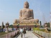
One can also go to Kathmandu by Flight from Semrabasa airport inside Nepal boarder, which is 70 Km from Motihari and 20 Km from Raxaul.Gaya : Introduction
Gaya was earlier a part of the ancient Magadh region. Gaya is also the headquarters of Gaya District.
Gaya is 100 kilometers south of Patna, and is situated on the banks of Falgu River. It is a place sanctified by both the Hindu and the Buddhist religions. It is surrounded by small rocky hills (Mangala-Gauri, Shringa-Sthan, Ram-Shila and Brahmayoni) by three sides and the river flowing on the fourth (western) side.
Gaya is covered by Jehanabad district on the north, on the south by Chatra district of Jharkhand. On the east by Nawada district and on the west by Aurangabad district.
Facts & FiguresLatitude240 5 to 25010 NLongitude840 4 to 850 5 EPopulation(2001)34,64,983Males17,89,231Females16,75,752Populationdensity696 Per Sq. K.M.SexRatio937LiteracyRate51.07%No.of Sub-Division04No.of Blocks24No.of Villages2860TemperatureMax.: 49 0C; Min.: 2 0CSTDCode0631
How to Reach
Roadways
The Grand Trunk Road (NH-2, which is undergoing a massive revival under The Golden Quadrilateral project) is about 30 km. from Gaya city. Thus, Gaya is well connected to Kolkata, Varanasi, Allahabad, Kanpur, Delhi, Amritsar, and to the Pakistani cities, Lahore and Peshawar. Though, the highway connecting Gaya to Patna is not in a good condition, the railway services between the two stations is up to the mark.
Railways
Gaya is the second most important station in Bihar after Patna. It is an important junction and is connected to the three metropolises New Delhi, Kolkata and Mumbai through Important Broad Gauge Routes. There is a direct non-stop train, the Mahabodhi Express from New Delhi to Gaya daily. It takes around 16 hours to reach Gaya from New Delhi through train.
There are direct trains from Gaya to other important stations in India like Ranchi, Varanasi, Lucknow, Kanpur, Allahabad, Agra, Mathura, Jabalpur, Bhopal, Indore, Nagpur, Puri, etc.
Airways
Gaya has the only international airport in Bihar and Jharkhand taken together. It is a small international airport connected to Colombo and Bangkok.Gopalganj : Introduction
Gopalganj is a part of Saran Division. It is an administrative district in the state of Bihar. The district headquarters are located in the town of Gopalganj.
Gopalganj is an important agricultural center in North Bihar.
Facts & FiguresArea2033 Sq. kmPopulation (2001)21,49,343Males10,72,151Females10,77,192Population density1057 Per Sq. kmSex Ratio1005Literacy Rate48.19%No. of Sub-Division02No. of Blocks14STD Code06156
How to Reach
The NH 28 intersects at Gopalganj.Jamui : Introduction
Jamui was formed in 1991, after it was separated from Munger. Various literatures show that Jamui was earlier known as Jambhiyaagram. This place is situated on the bank of river named Ujjihuvaliya. According to Jainism the 24th Tirthankar Lord Mahavir acquired divine knowledge at this place.
Jamui district is surrounded by Munger and Lakhisarai district on the north, on the south by Giridih district of Jharkhand. On the east by Deoghar and Banka district and on the west by Nawada district.
The major rivers flowing in the district are Kiul, Burnar, Sukhnar, Nagi, Nakti, Ulai and Bunbuni.
Attractions
The main places to visit are Minto Tower at Giddhaur, Kali Mandir at Malaypur, Jain Mandir Dharmshala, Kshatriya Kund Gram, Giddheshwar Temple, Kakan, Indpai, Kumar Gram, Simultalla
Facts & FiguresYear of formation21st February, 1991Area3,122.80 sq. kms.Population (2001)13,97,474Males7,28,812Females6,68,662Population density451 Per Sq. K.M.Sex Ratio917Literacy Rate42.74%No. of Blocks10Average rainfall1,102.9 mm.TemperatureMax.: 41 0C ; Min.: 13 0CSTD Code06345
Jehanabad : Introduction
Jehanabad came into existence in 1986. Earlier it was a part of the present Gaya district. The district was divided so that the problem of poverty, unemployment and underdevelopment could be tackled easily. The district headquarters is located at Jehanabad city.
The Jehanabad district is bounded by district of Patna in the north, Gaya in the south, Nalanda in the east and Arwal in the west.
Rivers
The important rivers flowing through the district are Sone, Phalgu, Dardha & Yamuna cris-cross the district.
Attractions
Important places to visit are Barabar - Land of Peace & Tranquillity, Banavar Dwar
Facts & FiguresYear of formation1st August, 1986Area1569 Sq. kmLatitude250 -0’ to 250 15’ NLongitude840 31’ to 850 15’ EPopulation (2001)15,11,406Males7,83,960Females7,27,446Population density963 Per Sq. kmSex Ratio928Literacy Rate56.03%Average rainfall1074.5 mmSTD Code06114
How to Reach
The district is linked both by road route and rail route.
Roadways
The road route is via Masaurhi block of Patna district, which goes directly to Gaya via Makhdumpur block of the district.
Railway
The Patna-Gaya branch railway line, popularly known as the “P.G. Line”, crosses through this district and links the main line of Patna and Grand Chord Line of Gaya. There are four-railway stations and a 31 km long railway line in this district.Katihar : Introduction
Katihar District is a part of Purnia division. Katihar town is the administrative headquarters of this district.
Facts & FiguresArea3,057 sq. kms.Latitude250 30 NLongitude870 40 EPopulation (2001)23,89,533Males12,44,943Females11,44,590Population density782 Per Sq. kmSex Ratio919Literacy Rate35.29%No. of Sub-Division04No. of Blocks16STD Code06452
How to Reach
The district is well connected by railways. Katihar is an important Railway Junction of the district. Trains ply directly from New Delhi, Jammu, Amritsar, Patna, Sialdah, Dadar, Barauni, Guwahati, New Jalpaiguri, Maldah, Jogbani & all other major stations.Khagaria : Introduction
Khagaria District is a part of Munger division. Khagaria town is the administrative headquarters of this district.
The district is surrounded by Saharsa district on the north, on the south by Munger and Begusarai district. On the east by Bhagalpur and Madhepura district and on the west by Begusarai and Samastipur district.
The principal rivers flowing through the district are the Ganga, the Burhi Gandak, the Bagmati, the Kamla and the Ghaghri. The Ganga forms the southern boundary of the district in its entire length.
Important places to visit are Katyayani Asthan, Ajgaibinath Mahadeo (Bhagalpur)
Facts & FiguresYear of formation10.05.1981Area1485.8 Sq. kmLatitude250 15" to 250 44" NLongitude860 17.14 " to 860 52.5 " EPopulation (2001)12,76,677Males6,75,501Females6,01,176Population density859 Per Sq. kmSex Ratio890Literacy Rate41.56%No. of Sub-Division02No. of Blocks07No. of Villages306Average rainfall1225.6 mmTemperatureMax.: 39.2 0C; Min.: 7.1 0CSTD Code06244How to Reach
This district is well connected to other parts of Bihar and the country through railways as well as roads.
Railways
New Delhi – Gauhati railway lines passes through Khagaria. Other prominent stations are Mansi, Maheshkhunt and Pasraha
Roadways
NH- 31 falls within the jurisdiction of Khagaria district. NH-31 goes right upto Gauhati and is an important road link of Bihar to the north – eastern part of the country and to Northern Bengal.
Kishanganj : Introduction
Kishanganj was earlier animportant Sub-Division of Purnia. The Kishanganj District came into existenceon 14th January 1990.
Kishanganj is situated inthe North – East area of Bihar. The borderingareas are of West Bengal, Nepal and Bangladesh.
The important riversflowing from the district are Mahananda, Kankai, Mechi, Donk, Ratua, RamzanSudhani
The important places tovisit are Panighat, Udraghat, Sevoke
Facts & FiguresYearof formation14thJanuary 1990Area1938.55Sq. kmLatitude25020’to 26030’ NorthLongitude8707’to 88019’ EastPopulation(2001)1294063Males666910Females627153LiteracyRate34.26%No.of Sub-Division01No.of Tehsil07No.of Blocks07No.of Villages802Averagerainfall2250mmTemperatureMax.:41 0C; Min.: 5 0CSTDCode06456How to Reach
The district has 6 railway stations at Kishanganj, Pothia, Taiyyabpur, Thakurganj, Piprithan, Galgaliya.
Nearest Airport is at Bagdogra (90 km. approx)
Lakhisarai : Introduction
The district of Lakhisarai came into existence in the year 1994 before which it was a part of the Munger district.
Lakhisarai is bounded by Munger in the east, in the south by Sheikhpura, in the west by Begusarai and in the north by Patna.
Rivers
The important rivers flowing through the district are the Ganges, Kiul and Harohar.
Attractions
The important places to visit are Rajauna, Kabaiya, Nongarh, Barahiya, Shringirishi, Abhinath Asthan, Bhagwati Asthan
Facts & FiguresYearof formation3rd of July 1994Area1293.97 Sq. kmLatitude250 to 250 20’ NLongitude850 55’ to 860 25’ EPopulation(2001)8,01,173Males4,16,727Females3,84,446Population density652 Per Sq. kmSex Ratio923LiteracyRate48.21%No.of Sub-Division01No.of Blocks06No.of Villages472TemperatureMax.: 45 0C; Min.: 4 0CSTDCode06346
How to Reach
Basically the people of Lakhisarai district depend on Railway and Roadways for transportation and communication.
N.H. 80 traverses about 75 km. in northern part of the district through Barahiya, Lakhisarai and Surajgarha. About 60% villages have been linked with metallic Road. Railway main and loop line pass through the district headquarter and cross each other at Kiul junction.Madhepur : Introduction
Madhepura is located in the northeastern part of Bihar and is situated in the plains of river Koshi.
Madhepura district is surrounded by Araria and Supaul district in the north, Khagaria and Bhagalpur district in the south, Purnia district in the east and Saharsa district in the West.
Facts & FiguresYearof formation09/05/1981Latitude25°. 34 to 26°.07’ NLongitude86° .19’ to 87°.07’ EPopulation(2001)1524596Males797180Females729466Population density852 Per Sq. K.M.Sex Ratio915No.of Blocks13No.of Villages441STDCode0612
How to Reach
The district is linked with meter gauge Rail of North Eastern Railway. The district is located on Katihar, Saharsa, Samastipur meter gauge Rail Section. In addition to Rail link it is connected with state H.Q.by road that starts from NH 31 at Maheshkhut and ends at Baijnathpur situated in between Madhepura and Saharsa link road at the distance of 14 KM from Madhepura.Madhubani :Munger : Introduction
Munger came into existence as a separate centre in the year 1812.
Munger District is located in the southern part of Bihar and its headquarter is located on the southern bank of river Ganges.
The district of Munger is surrounded by the Ganges in the north, Bhagalpur district in the east, Barh district in the west and the district of Jamui in the south.
Munger district has long been famous for its mineral waters and hot water springs,
Attractions
Religious Places
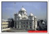
Chandika Astahan, Kastaharni Ghat, Pir Shah Nafah Shrine, Sita Kund, Manpathar (Sita Charan), Ucheswar Nath, Gurudwara At Piparpanti, Goenka Sivalaya ( Machchli Talab), Baptist MissionSri Krishna Vatika, Pirpahar, Bhimbandh, Kharagpur Lake, Malnipahar, Safiabad- Mirza, Mullah Mohammad Sayyid Grave, Shah Mustafa Sufi’s Grave - Dilawarpur, Haha Punch Kumari, Rameshwar Kund, Rishikund, Sringirikh, Lachhuar, Simultala
Facts & FiguresArea1419.7 sq.kmLatitude240 22 N to 250 30 N.Longitude850 30 E to 870 3 EPopulation(2001)1135499Males604662Females530837Population density800 Per Sq. K.M.Sex Ratio876Literacy Rate60.11%No. of Sub-Division03No.of Blocks09No.of Villages903Average rainfall1231 mm.STDCode06344
Muzaffarpur : Introduction
The Muzaffarpur district is famously known as the “Land of Leechi”. The district was created in 1875 by splitting the Tirhut district for administrative convenience.
The district is bounded by the Purbi Champaran and Sitamarhi district on North, on the South by Vaishali and Saran district, on the East by Darbhanga and Samastipur district and on the West by Saran and Gopalganj district.
The district has now also won international praise for its delicious Shahi Leechi and China Leechi.
Rivers
The important rivers flowing through the district are Bagmati, Gandak, Burhi Gandak, and Lakhandeyee
Facts & FiguresYear of formation1875Area3175.91 Sq. K.M.Latitude25O 54’ TO 26O 23’NLongitude84O 53’ TO 85O 45’ EPopulation(2001)3743836Males1941480Females1802356Population density1180 Per Sq. K.MSex Ratio928Literacy Rate47.69%No. of Sub-Division02No.of Blocks16No.of Villages1811Average rainfall118.7 mm.TemperatureMax.: 44 OC ; Min.: 5 OCSTDCode0621
Nalanda : Introduction
Nalanda district is a part of the Patna division. Bihar Sharif town is the administrative headquarters for this district.
Attractions
Important places to visit are the Nalanda University, Rajgir, Swarna Gufa, Griddhakuta Parvat, and Vishwa Shanti Stupa, Bihar Sharif, Bodh Gaya
Facts & FiguresArea2367 Sq. kmPopulation (2001)23,68,327Males12,36,467Females11,31,860Population density1006 Per Sq. kmSex Ratio915Literacy Rate53.64%No. of Sub-Division03No. of Blocks20STD Code06112
How to Reach
By Air
The nearest airport from Nalanda is Patna which is about around 89 km away. There are regular flights from Patna to Kolkata, Delhi, Ranchi, Mumbai, Varanasi, Lucknow, and Kathmandu.
By Rail
Rajgir, 12 km away, is the nearest railway station from Nalanda. There are several passenger trains running between Rajgir and Patna daily. The nearest major railway point is Gaya around 65 km away, from where one can board trains for Delhi, Kolkata, Varanasi, and some of the major centers in eastern India.
By Road
Nalanda is connected by a good road network with Rajgir 12 km, Bodh Gaya 50 km, Gaya 65 km, Patna 90 km, Pawapuri 26 km, and Bihar Sharif 13 km.
Nawada : Introduction
Nawada district is situated in the Magadh division. Nawada town is the administrative headquarters of this district.
Attractions
Important places to visit are Kakolat - A Famous Fall, Republic Door, Handiya Sun Temple, Mazar of Baba, Sitamari
Facts & FiguresArea2494 Sq. kmLatitude240 53 NLongitude850 35 EPopulation(2001)18,09,425Males9,28,638Females8,80,787Population density726 Per Sq. kmSex Ratio948Literacy Rate47.36%No. of Sub-Division02No.of Blocks14STDCode06324
Patna : Introduction
Patna is the capital of the state Bihar. The original name of Patna was Pataliputra.
The district lies virtually in the heart of the South Bihar Plain. Patna city is the administrative headquarters for this district. The Patna district is bounded on the north by the Ganges, beyond which lies the district of Saran, Vaishali, Samastipur and Begusarai. To the east lies the district of Lakhisarai and Nalanda and in the south the district of Jahanabad. Patna is separated from Bhojpur district on its west by river Sone.
River
The most important river is the Ganga which is navigable through out the year and there is considerable boat traffic for transporting cargo. The smaller rivers like Punpun and Dardha become navigable only during the rainy season when they can be used for transporting agricultural produce to the grain market at Fatwah.
Attractions
Important places to visit are Agamkuan, Botanical & Zoological Garden, Gandhi Sangrahalaya, Golghar, Jalan Museum, Kumhrar, Mahavir Temple, Martyr's Memorial, Patna Museum, Padri Ki Haveli, Pather Ki Masjid, Planetarium, Sadakat Ashram, Srikrishna Science Centre, Sher Shah Suri Masjid, Takht Harmandir
Facts & FiguresArea3202 Sq. kmLatitude250 25 NLongitude850 10 EPopulation (2001)47,09,851Males25,14,949Females21,94,902Population density1471 Per Sq. kmSex Ratio873Literacy Rate63.82%No. of Sub-Division06No. of Blocks23Average rainfall1200 mmSTD Code0612
How to Reach
Roadways
Patna is well served by a network of well maintained roads. National Highway No.31 passes through Dinapur, Patna and Patna City. While one branch goes to Barauni via Barh, another proceeds to Nawada via Bihar.
All the sub-divisional headquarters of the district (except the newly created subdivision of Masaurhi) are situated on this National Highway which provides the road link between North and South Bihar.
Railways
The main line of the Eastern Railway passes through the entire length of the district running parallel to the Ganga. There are three railway lines running across the district from north to south viz., the Patna Gaya Branch line the Fatwah-Islampur Light Railway and the Bakhtiarpur-Rajgir Branch line.
Except the Light Railway, the other two are branches of the Eastern Railway. With the opening of the famous Patna-Hajipur Bridge (Mahatma Gandhi Setu), the ferry service connecting the capital with the North-Eastern Railway System has ceased to function.
Airways
Patna is connected by air to Calcutta and Delhi and a few other places by Daily flights. There is an aerodrome near Phulwarisharif and another at BihtaPurnia : Introduction
Purnia is popularly known as a ‘Poor Man’s Darjeeling’.The districts of Araria, Katihar and Kishanganj were carved out from the Purnia district.
The Purnia district is surrounded by Araria district in the North, Katihar and Bhagalpur district in South, West Dinajpur district of West Bengal and Kishanganj district of Bihar in east and Madhepura and Saharsa District in the west.
Attractions
The important places to visit are Kajha Kothi, Goddess Puran Devi, Mata Asthan, Goddess Radha Krishna
Facts & FiguresArea3,229 sq. kmLatitude250 13’ 80” to 270 7’ 59 N”Longitude860 59’ 6” to 870 52’ 35” EPopulation (2001)2540788Males1325794Females1214994Population density787 Per Sq. kmSex Ratio916Literacy Rate35.51%No. of Sub-Division04No. of Blocks14No. of Villages1296Average rainfall1411.5 mmTemperatureMax.: 45.5 0C; Min.: 8.8 0CSTD Code06454
How to Reach
One may access Purnia District using Road & rail services. The district is connected with National Highway No. - 31 and the nearest Railway Station is Katihar which is linked with most of the important places of the country.
Private as well as State Govt. daily Bus services are available for Uttar Pradesh, Bengal, Assam, Orisa and Jharkhand. People of these states may reach here using bus services.Rohtas : Introduction
Rohtas started functioning as an independent district in 1972 before which it was a part of the Shahabad district. Sasaram is the headquarters of the Rohtas District.
Rohtas is surrounded by Bhojpur and Buxar district in the North, by Plamu and Garwah district in the South, by Aurangabad and a part of Gaya district in the East and by Kaimur district in the West.
The important river flowing through the district is Sone.
Attractions
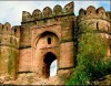
The important places to visit are Akbarpur, Akhorigola, Dehri, Deo Markandey, Rehal, Rohtas Garh, Sasaram, Shergarh, Tarachandi, Dhurwan Kund & Gupta Dham, Bhaluni Dham, Dharklandha
Facts & FiguresYear of formation10th November 1972Area3847.82 Sq. kmLatitude240 30” to 250 20” NLongitude830 14” to 830 20” EAltitude107.78 MetersPopulation (2001)2448762Males1282655Females1166107Population density636 Per Sq. kmSex Ratio909Literacy Rate50.57%No. of Sub-Division03No. of Blocks19No. of Villages2103Average rainfall952 mmSTD Code06184
How to Reach
Nearest Airport
Jaiprakash Narayan International Airport, Patna (147kms)Gaya International Airport, Gaya (About 125 kms)
Nearest railhead is at Sasaram (Eastern Railway)
By road
The district is well Connected by a network of well-maintained roads with all Indian cities. (GT Road passes through Sasaram)Saharsa : Introduction
Saharsa district became a separate district in 1954 prior to which it was a part of Kosi division.
The important rivers flowing through the district are Kosi, Baghmati
Atractions
Important places to visit are Tara Sthan at Mahishi, Chandika Sthan at Biratpur, Mandan Bharti Asthan, and Sun Temple at Kandaha, Laxminath Gosai Sthal at Bangoandewan Ban Mandir, Nauhatta, Udahi, Karu Khirhari Temple and Matsyagandha Mandir.
Facts & FiguresYear of formation1 April 1954Area1661.30 Sq. kmLatitude25.88° NLongitude86.6° EPopulation (2001)15,06,418Males7,88,585Females7,17,833Population density885 Per Sq. kmSex Ratio910Literacy Rate39.28%No. of Sub-Division02No. of Blocks10STD Code06478
How to Reach
Saharsa is connected by rail and road to other major towns in Bihar.
Road
National Highway NH - 107 connects it to Maheshkhunt and Purnia.
Rail
Earlier there was only a metre gauge line, but in early 2006, a much awaited broad gauge line connected it to Khagaria on the New Delhi Guwahati main line.
In early 2006, a weekly train was started to connect it to the national capital, New Delhi. In October 2006, a low fare completely air conditioned weekly train christened "Garib Rath" (Poor's Chariot), has been started to connect Saharsa to Amritsar, with much fanfare.Samastipur : Introduction
Samastipur is an administrative district in the state of Bihar. The district headquarters is located at Samastipur. It is situated at the banks of the Budhi Gandak River.
The district is bounded on the North by the Bagmati River which separates it from Darbhanga district, on the West by Vaishali and some part of Muzaffarpur districts, on the South by the Ganges, and on the East by Begusarai and some part of Khagaria districts.
The most important rivers following through the district are Burhi Gandak, the Baya, Kosi, Kamla, Kareh and Jhamwari and Balan.
The main festival of the district is Chhat Puja
Facts & FiguresArea2905 Sq. kmLatitude250 55 NLongitude850 5 EPopulation (2001)34,13,413Males17,71,249Females16,42,164Population density1175 Per Sq. kmSex Ratio927Literacy Rate45.76%No. of Sub-Division04No. of Blocks21No. of Towns05No. of Villages1237STD Code06274
How to Reach
Samastipur is the Divisional Headquarters of the North Eastern railway. The district has direct train link with Patna, Kolkata, Delhi, Dhanbad, Jamshedpur and other places of importance. National Highway No. 28 passes through the district.Saran : Introduction
The Saran district is a part of the Saran division. Saran is also known as Chhapra. Chhapra is the headquarters of the Saran district.
The Saran district is bounded by Siwan and Gopalganj districts in the north, the Ganges constitutes the southern boundary of the Saran district beyond which lies the districts Bhojpur and Patna. The Gandak forms the dividing line with Vaishali and Muzaffarpur district in the east and in the west lies district of Siwan and the Balia district of uttar Pradesh.
The district is shaped like a triangle with its apex at the confluence of boundary of Gopalganj district and Gandak-Ganga river there are three rivers namely the Ganga, Ghaghra, Gandak which encircle the district from south north east and western side respectively. The district is entirely constituted of plains but there are quite a few depressions and marshes, which cause the formation of three broad natural divisions.
Rivers
Important rivers flowing through the district are Ganges, Ghaghra, Gandak
Attractions
Important places to visit are Aami, Sonepur, Dhorh Ashram, Gautam Asthan, Silhauri, Chirand
Facts & FiguresArea2641 Sq. kmLatitude25°36' and 26°13' NLongitude84°24' and 85°15' EPopulation (2001)32,51,474Males16,54,428Females15,97,046Population density1231 Per Sq. kmSex Ratio965Literacy Rate52.01%No. of Sub-Division03No. of Blocks20No. of Villages1767STD Code06152
Sheohar : Introduction
Sheohar district came into existence in the year 1994, before which it was a part of Tirhut division. The district headquarters are located at Sheohar.
Facts & FiguresYear of formation06-10-1994Area443 Sq. kmLatitude260 2NLongitude850 3 EPopulation (2001)5,14,288Males2,71,261Females2,43,027Population density1161 Per Sq. kmSex Ratio896Literacy Rate37.01%STD Code06222
Shiekhpura : Introduction
Sheikhpura district is a part of the Munger Division. The Sheikhpura town is the administrative headquarters of this district.
Rivers
The important rivers flowing through the district are Ganges, Mohane, Harohar, Kiul
Facts & FiguresPopulation (2001)5,25,137Males2,73,468Females2,51,669Population density762 Per Sq. K.M.Sex Ratio920Literacy Rate49.01%STD Code06431
Sitamarhi : Introduction
The Sitamarhi district came into existence in the year 1972 after it was separated from the present Muzaffarpur district. Sitamarhi is situated in the northern part of Bihar. The district headquarter is located at Dumra, which is five kilometers south of Sitamarhi. The district is popularly known as the “Land of Goddess Sita”.
Boundary
The Sitamarhi district is bounded by Nepal on the north, Muzaffarpur on the south, by the districts Darbhanga and Madhubani on the east and on the west by the districts East Champaran and Sheohar.
Rivers
The important rivers flowing through the district are Bagmati, Lakhandei, Adhwara Group
Attractions
Important places to visit are Janaki Temple at Sitamarhi, Janaki Temple at Punaura, Deokuli, Haleshwar Sthan, Panth-Pakar, Bodhayan-Sar, Baghi Math, Pupri, Goraul Sharif, Shukeshwar Sthan, Sabhagachhi Sasaula
Facts & FiguresYear of formation11th December 1972Area2185.17 sq. kmLatitude26 ° 49 ' NLongitude85 ° 05 ' EAltitude85 MeterPopulation (2001)26,69,887Males14,10,149Females12,59,738Population density1214 Per Sq. kmSex Ratio893Literacy Rate39.38%No. of Sub-Division03No. of Blocks17Average rainfall1100 to 1300 mm.STD Code06226
Siwan : Introduction
Siwan is located in the western part of the state. The district came into existence in 1972; previously it was a part of Saran district.
The Siwan district is bounded by Deoria district (U.P.) from west, Gopalganj district from north, Saran district from east and by the river Ghaghara (Gogra or Sarayu) from south, beyond which lies the district of Ballia (U.P.).
Rivers
Rivers flowing through the district are Jharahi, Daha, Gandaki, Dhamati (Dhamahi), Siahi, Nikari and Sona.
Attractions
The important places to visit are Amarpur, Faridpur, Darauli, Don, Hasanpura, Lakri Dargah, Maharajganj, Mairwa Dham, Mehandar, Ziradei, Bhikhabandh,
Facts & FiguresYear of formation11th December 1972Area2219 sq. kmLatitude250 53' to 260 23' NLongitude840 1' to 840 47' EPopulation (2001)27,08,840Males13,32,218Females13,76,622Population density1221 Per Sq. kmSex Ratio1033Literacy Rate52.01%No. of Sub-Division02No. of Blocks19No. of Villages1530Average rainfall1200 mmSTD Code06154
How to Reach
The district is connected through railways. Siwan is an important railway station of the Northern Eastern Railway as over here main traffic of sugar and vegetable are dealt.
The district is not connected by any state highway. But then also it is connected through some important metalled roads which serve as the important route for transport.Supaul : Introduction
Supaul district is a part of the Kosi division. Supaul town is the administrative headquarters of the district.
The district is bounded by Nepal in the north, Saharsa in the south, by Araria district in the East and on the west by Madhubani district.
Facts & FiguresLatitude2507' o 260 2 NLongitude860 2'to 870 90' EPopulation (2001)17,45,069Males9,08,855Females8,36,214Population density724 Per Sq. kmSex Ratio920Literacy Rate37.80%No. of Sub-Division04No. of Blocks11No. of Villages554
Vaishali : Introduction
Vaishali district came into existence in 1972. Earlier it was a part of Muzaffarpur district. The Vaishali district is a part of Tirhut division and the district headquarters are at Hajipur town.
Agriculture is the main activity and banana, paddy, wheat, maize and lentils are the major crops.
The district is bounded by the district Muzaffarpur in the north, district Samastipur in the east and by river Ganga in south and river Gandak in west.
Rivers
The important rivers flowing through the district are Ganges and Gandak.
Facts & FiguresYear of formation12/10/1972Area2036 Sq. kmLatitude25° to 30° NorthLongitude84° to 85° EastPopulation (2001)27,12,389Males14,12,276Females13,00,113Population density1332 Per Sq. kmSex Ratio921Literacy Rate51.63%No. of Sub-Division03No. of Blocks17STD Code06224
How to reach
The state capital Patna is linked with famous Mahatma Gandhi Setu.
Airways
The nearest airport is Patna (70 Kms).
Railways
Hajipur on the north eastern railway station (35 Kms) from Muzaffarpur Railway station (40 Kms)
Roadways
Vaishali is well connected by road to Patna (56 Kms), Muzaffarpur (36 Kms) and Hazipur (35 Kms).West Champaran : Introduction
West Champaran is a part of the Tirhut division. It is an administrative district and the district headquarters are located at Bettiah.
Facts & FiguresArea5228 Sq. kmLatitude26.81°NLongitude84.50°EPopulation (2001)30,43,044Males16,00,853Females14,42,191Population density582 Per Sq. kmSex Ratio901Literacy Rate39.63%


